


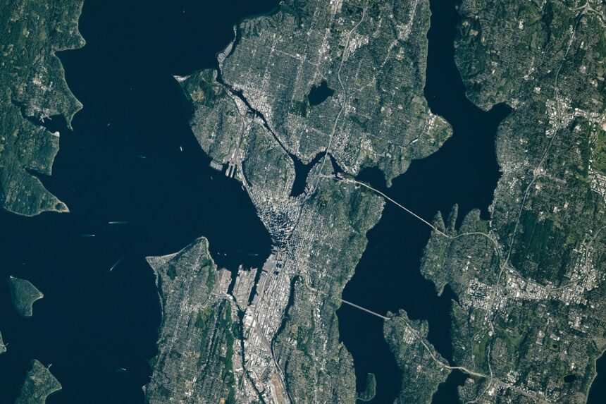
An astronaut aboard the International Space Station captured a striking view of Seattle on June 16, 2026, highlighting the unique geography of the "Emerald City." The region's distinct topography, defined by hills and waterways, is the result of Seattle landscape evolution driven by both ancient glacial activity and significant human engineering projects that have reshaped the land over the last century.
How did glaciers shape Seattle?
The Puget lobe of the Cordilleran ice sheet carved the region's basins between 18,000 and 16,000 years ago. This massive ice movement created the city's drumlins—elongated hills running north-south—and deposited large glacial erratics, such as the 20-foot-tall Wedgwood Rock, across the landscape.
What human changes altered the city?
Human development projects significantly modified the terrain, including leveling Denny Hill and filling in tideflats at the mouth of the Duwamish River. In the 1910s, engineers constructed the Montlake Cut and Ballard Locks to connect Puget Sound with Lake Washington, permanently altering the region's hydrology and water levels.