


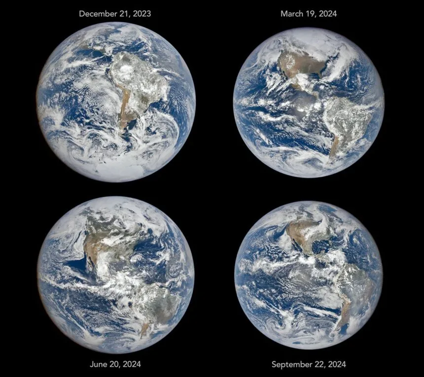
NASA cameras positioned in deep space capture unique full-disk images that clearly demonstrate how deep space images reveal Earth seasons through the 23.5-degree axial tilt that shifts continents throughout the year. Released to highlight planetary observation data, these observations from roughly one million miles away help scientists and the public visualize solstices and equinoxes from a global perspective.
What do space images show about Earth seasons?
Images taken across solstices and equinoxes reveal how Earth's axial tilt alters the visible face of the planet. During December, South America and Antarctica dominate the view, whereas June imagery highlights North America and Arctic sea ice due to the changing angle of sunlight.
Aside from seasonal tilt effects, satellite positioning creates subtle variations in apparent planetary size. Because the spacecraft follows a looping Lissajous orbit around Lagrange point 1, its distance from Earth swings by tens of thousands of miles roughly every three months. This orbital geometry also alters the illumination angle between the Sun, Earth, and satellite, changing how fully rounded the planet appears in captured imagery.
Why is deep space Earth observation important?
Long-term satellite monitoring provides researchers with continuous data on daily and seasonal cycles across a planetary scale. This information helps scientists observe key environmental features including vegetation, clouds, ice, snow, and aerosols over many years.
Operating from a vantage point between the Sun and Earth allows instruments to maintain a nearly continuous view of the sunlit hemisphere. Experts note that these deep space missions offer valuable insights into global environmental patterns and atmospheric conditions, improving how researchers track seasonal changes on Earth.